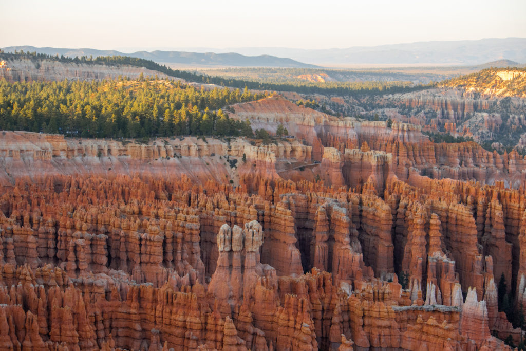
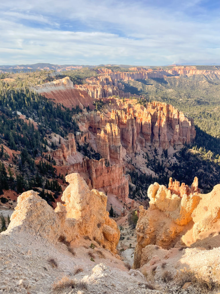
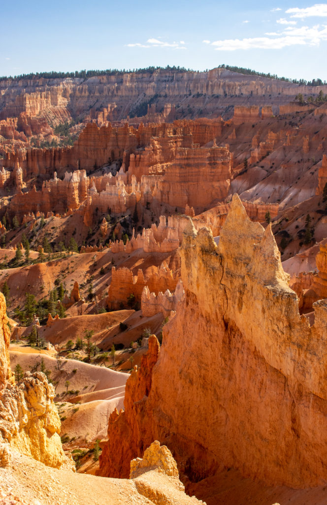
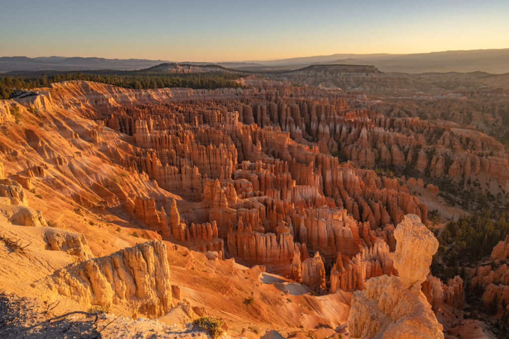
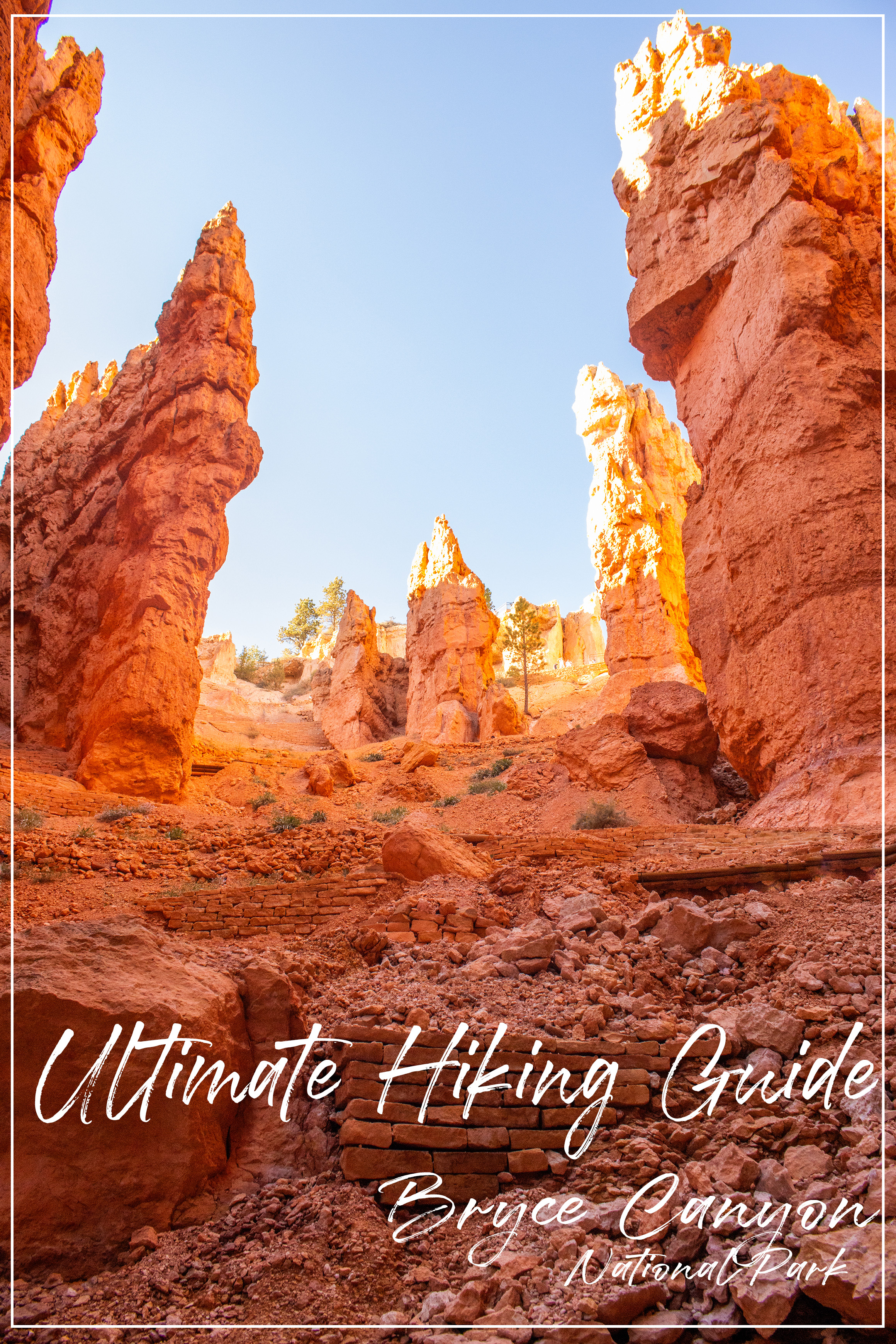
Bryce Canyon has some of the most incredible hikes in the United States. There’s trails for people of all hiking abilities, so you don’t have to be an advanced hiker to experience the best of the park. There is truly no other place in the world that looks like Bryce Canyon, it’s so unique! Hike on trails at the rim, or down in the hoodoos, you don’t want to miss beautiful national park!
Getting There
From The West
Las Vegas is the nearest airport to the park, about a 4 hour drive away. If you are coming from this direction, take I-15 north and take exit 95 to start heading east. Turn right on 89, and then head east again on highway 12. This road is beautiful and goes right through Red Canyon, a perfect roadtrip pitstop. You can also take the Hurricane exit off of I-15 if you are looking to hit Zion National Park on the way.
From The East
If you’re traveling from Moab, take 70 west to 89, then head east again on highway 12. From Page, AZ, just follow highway 89 all the way up to 12. It’s little less than a 3 hour drive from Page.
Best Time To Visit
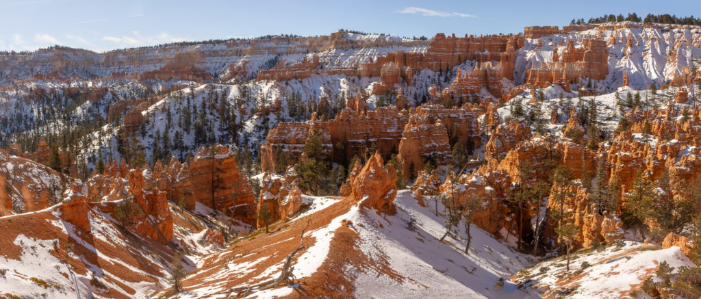
The best time of year weather-wise is in the spring and fall. In May, early June, and September, the high for the temperature is around the 70’s. However, this is when the park is most crowded, so if you are looking to visit with less crowds, I would go in late November or December. You may just have to dress in layers. The snow also makes the park even more beautiful, but sometimes it causes road and trail closures. If you want to be able to experience the entire park, you want to visit between April and October, but just know that this is when the park is most crowded.
Note: Park shuttles only run from April to mid-October. Miles 4-18 of Bryce Canyon Road may close due to winter weather.
What To Pack
Refillable water bottle – water refill stations are available throughout the park, but bring a big water bottle to stay hydrated on your hikes.
Layers of clothing – it gets chilly in the fall and spring month at Bryce, but you will get warm once you start hiking. It’s better to have the layers and take them off than to not have them at all.
Sturdy hiking shoes – some of the trails are rocky, so having proper shoes will help prevent you from slipping.
Snacks – although there are a few places to eat in the park, if you want to save your money, bring your own snacks so you have them to reenergize yourself on the trails.
Sunscreen – the sun can be strong at 9,000 feet of elevation! Bring sunscreen to protect your skin while you hike.
Sun hat – this is another way to protect yourself from the sun. The sun will make you tired a lot faster, so it’s best to protect yourself from it as much as you can.
Fees
Private vehicles cost $35 for a 7 day pass. Passes can be purchased online or at the entrance booths. Bryce Canyon annual pass costs $70 and will give you access for 12 months from the date of purchase. The America the Beautiful Pass is also accepted.
Hiking Trails
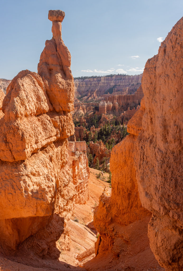
1. Queens Garden
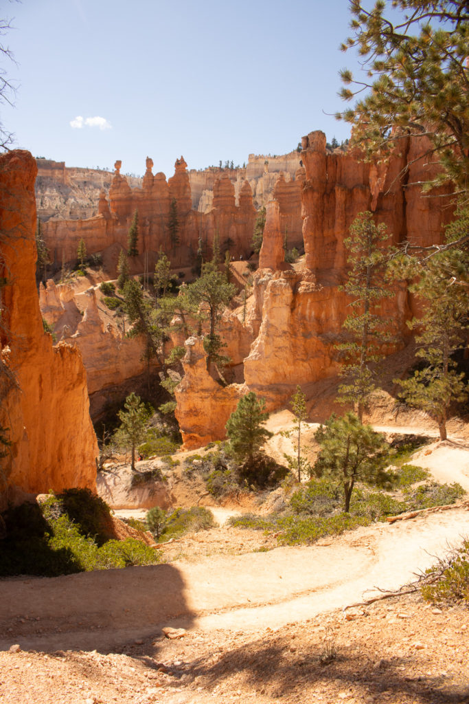
The Queen’s Garden trail is one of the most popular trails in the park, due to its easy to moderate difficulty and the close up views of the hoodoos. The trail begins at sunrise point, and descends into the amphitheater, eventually leading to a certain hoodoo named Queen Victoria, which resembles the queen if you use some imagination.
Length: 2.1 miles
Difficulty: easy – moderate
Elevation gain: 459 ft.
Estimated time: 1 hour 10 min – 1 hour 40 min
Family Friendly? Yes! The trail is smooth the whole way.
Dogs? No, for their own protection and the protection of local plants and animals
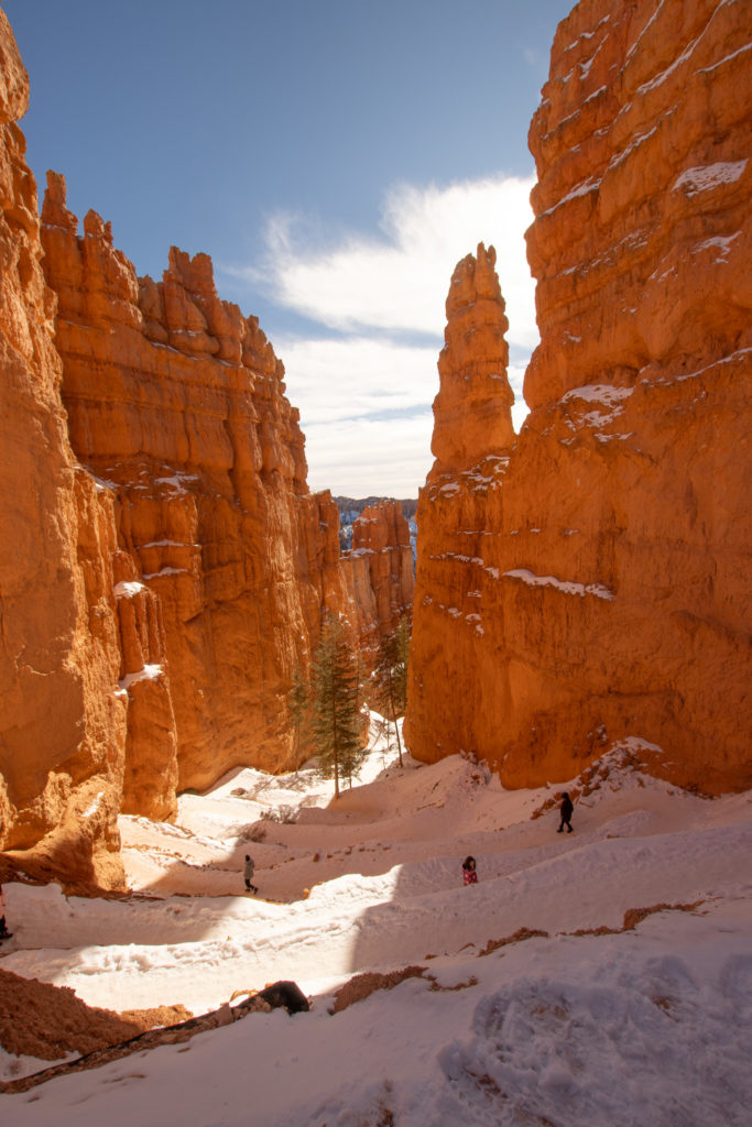
2. Navajo Loop
Nearby, starting at sunset point, is the Navajo Trail. This trail is famous for the switchback through the huge red rock spires. This trail is a great one to experience the inside of the amphitheater. It is also one of the easier trails in the park.
Length: 1.5 miles
Difficulty: easy – moderate
Elevation gain: 515 ft.
Estimated time: 1 hour – 1 hour 20 min
Family Friendly? Yes! The trail is smooth the whole way.
Dogs? No, for their own protection and the protection of local plants and animals
3. Queens Garden and Navajo Loop
Want to do both of those trails? This loop combines the Queen’s Garden and Navajo trails into a larger loop so you can see both without doing two out and back hikes. It starts at sunset point, goes down in the amphitheater and back up to sunrise point where you will hike along the rim back to sunset point.
Length: 3.0 miles
Difficulty: easy – moderate
Elevation gain: 652 ft.
Estimated time: 1 hour 40 min – 2 hours
Family Friendly? Yes! The trail is smooth the whole way.
Dogs? No, for their own protection and the protection of local plants and animals
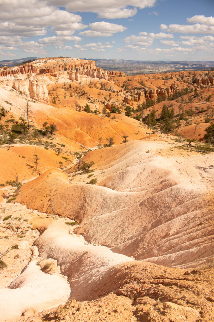
3. Fairyland Loop
This is one of my favorite hikes in the park, but it is one of the more challenging. It’s a large loop at the northern part of the amphitheater, and often has way less people on it than other trails. The elevation gain makes it tough, but you get to see a whole different part of the canyon. At about 1.7 miles in, you can take a pitstop to see Tower Bridge, rock spires that resemble London Bridge.
Length: 7.9 miles
Difficulty: moderate – difficult
Elevation gain: 1,555 ft.
Estimated time: 4 – 5 hours
Family Friendly? It’s one of the more challenging trails due to the large elevation gain, so it may not be for everyone.
Dogs? No, for their own protection and the protection of local plants and animals
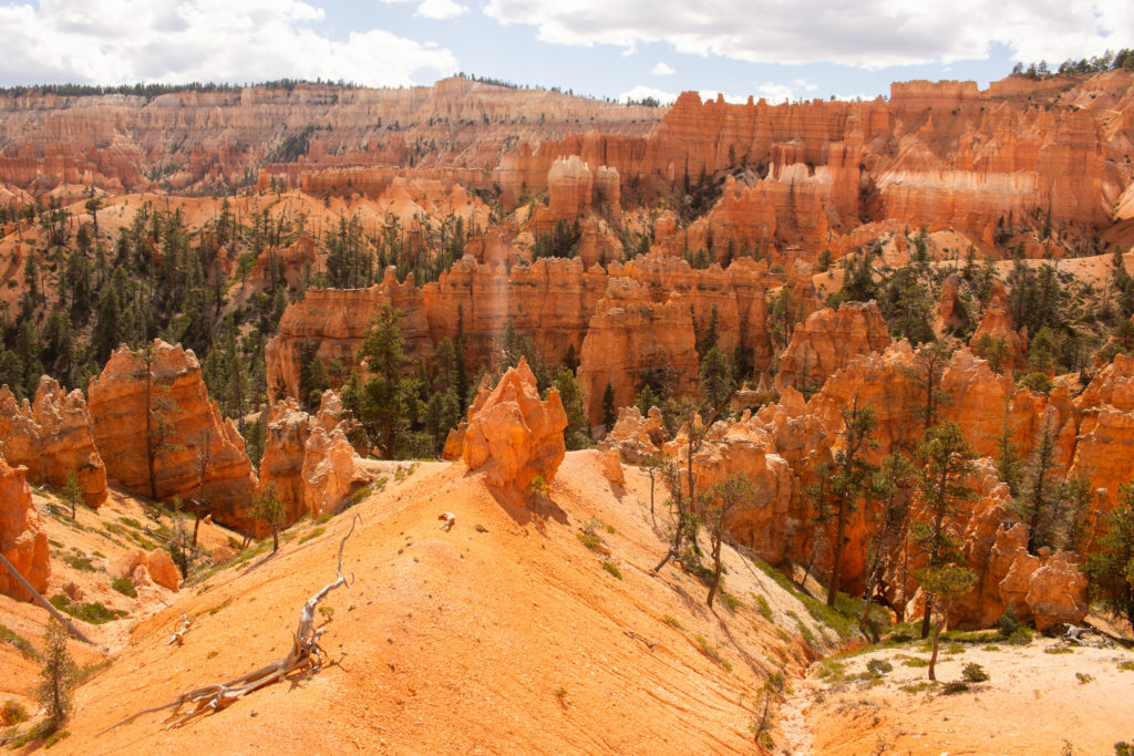
4. Peekaboo Loop
Another popular trail, Peekaboo Loop begins at Bryce Point at 8,300 ft. and descends into the canyon to about 6,800 ft. and goes through red rock hoodoos and trees, and back up the Bryce Point. It’s a steep trail in some areas, but definitely a fun challenge.
Length: 5.2 miles
Difficulty: moderate – difficult
Elevation gain: 1,528 ft.
Estimated time: 3 hours – 3 hours 30 min
Family Friendly? Yes! The trail is smooth the whole way. However, expect a steep elevation gain throughout.
Dogs? No, for their own protection and the protection of local plants and animals
5. Hat Shop
The hat shop is another favorite of mine, and one of the less crowded trails. The views are very different from the rest of the canyon, and at the end, the rock formations are so unique, it’s hard to believe they’re actually natural. The rocks resemble hats on display for sale, hence the name: Hat Shop.
Length: 4.0 miles
Difficulty: moderate
Elevation gain: 967 ft.
Estimated time: 2 hour 10 min – 20 hour 30 min
Family Friendly? This trail is a bit rocker and narrower in some spots, check with everyone you are hiking with to make sure they are comfortable with these conditions
Dogs? No, for their own protection and the protection of local plants and animals
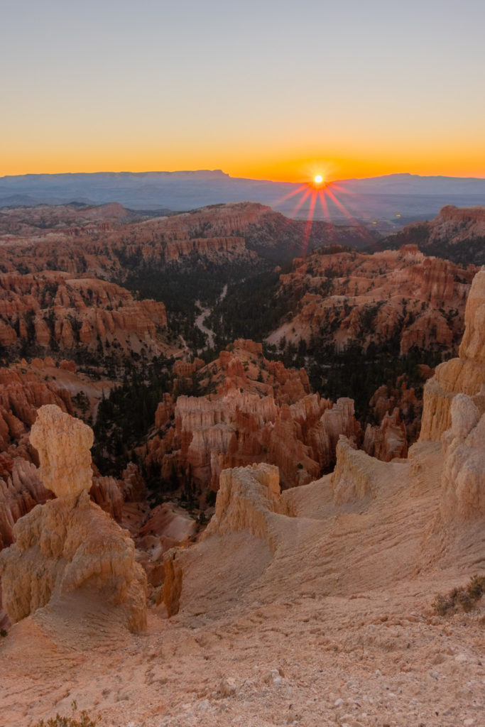
6. Inspiration Points
Lacking inspiration? Try watching the sunrise from these iconic viewpoints – it’s magical. Inspiration point is very accessible from the shuttle stop/parking lot and consists of three different points. All of it is paved and the lookouts have fences. In my opinion, this is the best overall view of Bryce Canyon, and the best place to watch the sunrise.
Length: 0.5 miles
Difficulty: easy
Elevation gain: 134 ft.
Estimated time: 30 mins
Family Friendly? Yes! The trail is smooth the whole way and easily accessible.
Dogs? No, for their own protection and the protection of local plants and animals
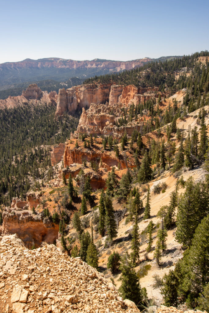
7. Sheep Creek and Swamp Canyon Loop
Just a short drive down Bryce Canyon road, is a much quieter area of the park. There’s not as many hoodoos but lots of trees and distant mountains. It’s great if you are looking for a change of scenery. This trail is only accessible by car, the shuttles do not go past Bryce Point.
Length: 4.5 miles
Difficulty: moderate
Elevation gain: 892 ft.
Estimated time: 2 hours 15 min – 2 hours 40 min
Family Friendly? Yes! There are no steep edges on this trail, but some significant elevation gain.
Dogs? No, for their own protection and the protection of local plants and animals
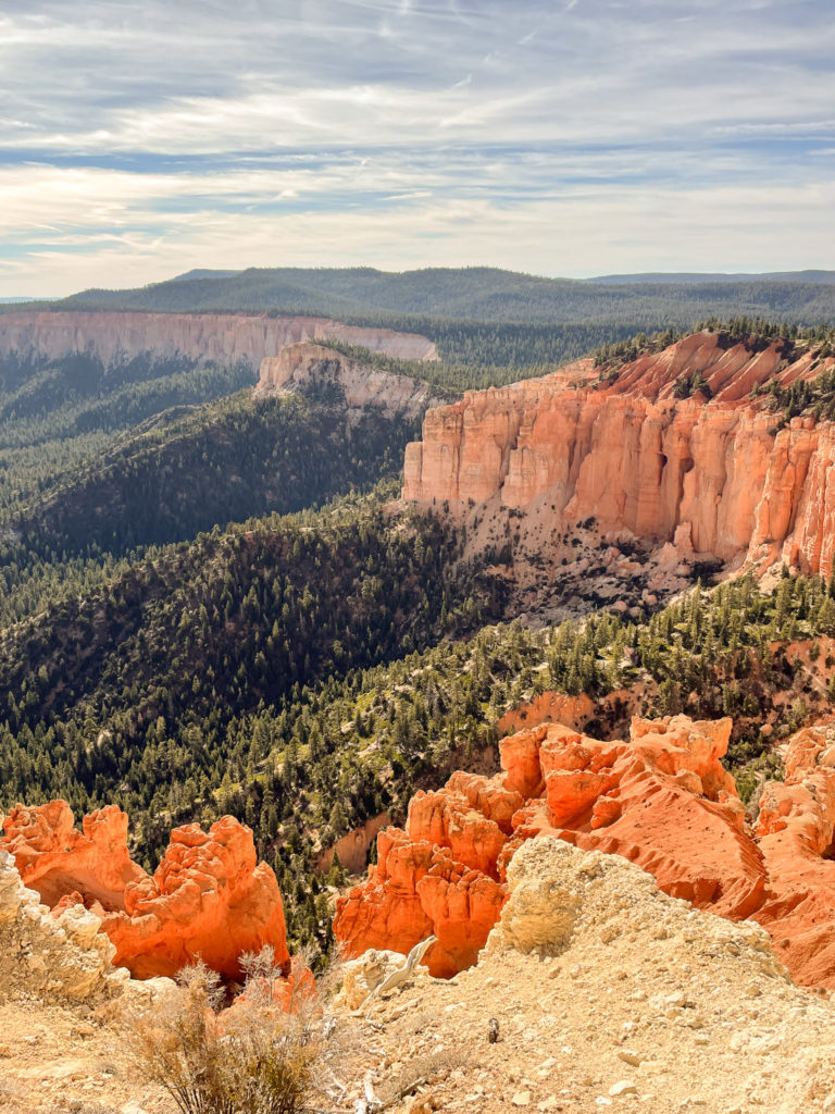
8. Bristlecone loop
Bristlecone loop is a small hike all the way at the most southern point, yet the highest point of the park. Here you will find views of tree covered mountains and see thousand year old bristlecone pines. Rainbow point and Yovimpa point are also nearby, and easily accessible from the parking lot.
Length: 1.0 miles
Difficulty: easy
Elevation gain: 88 ft.
Estimated time: 30 mins
Family Friendly? Yes! The trail is smooth and mostly flat.
Dogs? No, for their own protection and the protection of local plants and animals
Dogs?
You also may have noticed that none of the trails listed above allow dogs. If you want to bring your pet, they must stay on paved surfaces like roads and campgrounds, the shared-use path, or the 1/2 mile section of the rim trail between sunrise and sunset point. In order to preserve the trails, no dogs are permitted unfortunately. However, they can still go camping with you and enjoy the paved areas of the park!
You won’t find anywhere else on earth like Bryce Canyon as it truly is one of those places you just have to see for yourself. Its unique colors and rock formations are like no other, and they are absolutely incredible to hike through. Be sure to add this national park to your Utah roadtrip or your next vacation to the American southwest!
Love these photos?
Click here to see more photos from Bryce Canyon and the United States! All photos are available for purchase as high quality downloads.