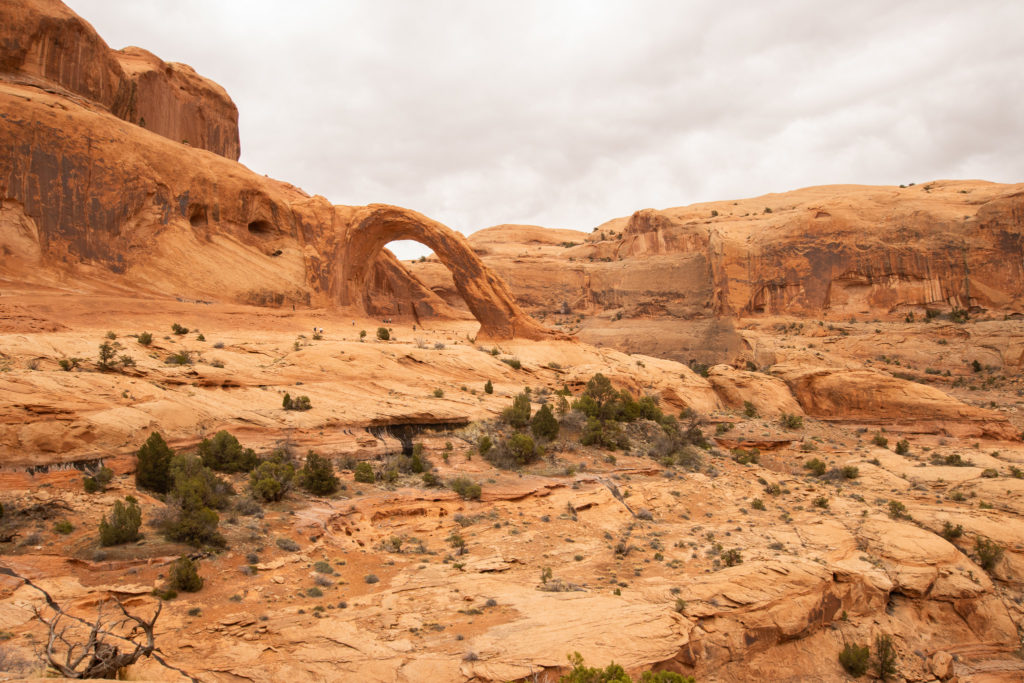
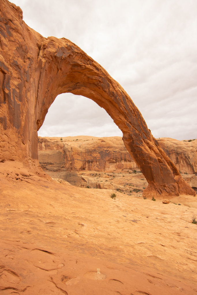
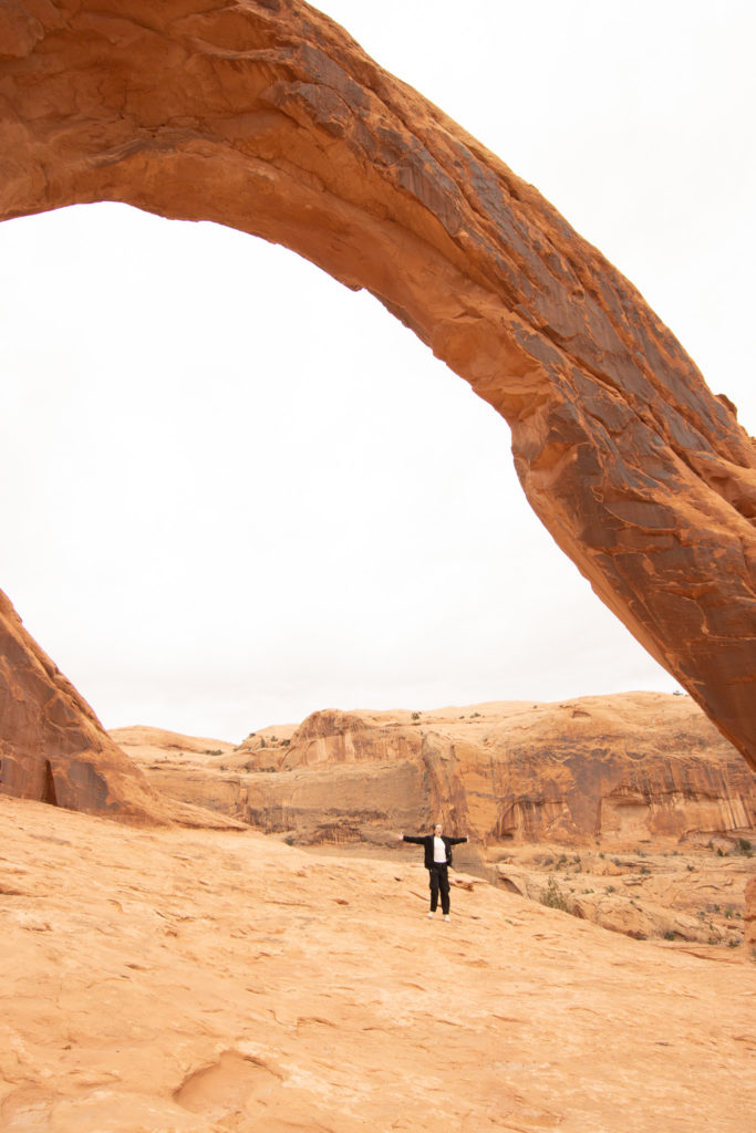
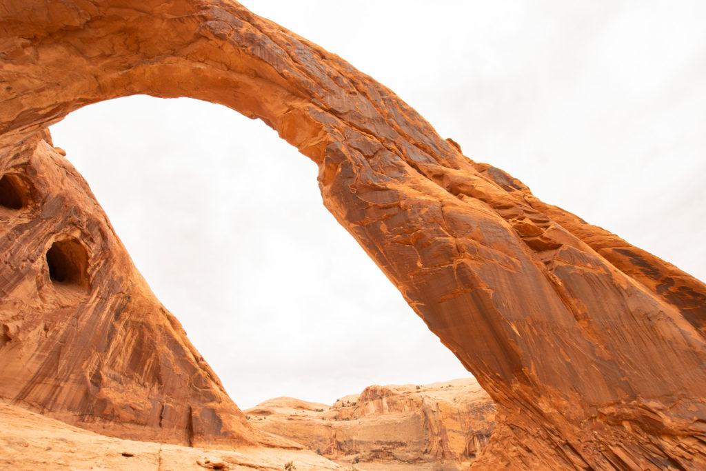
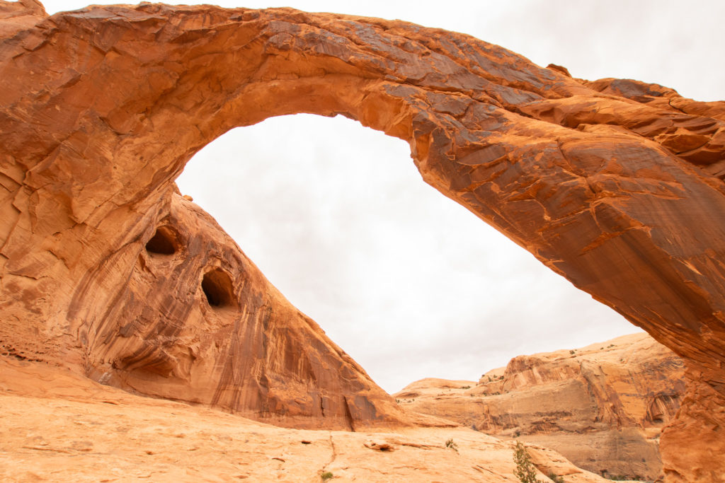
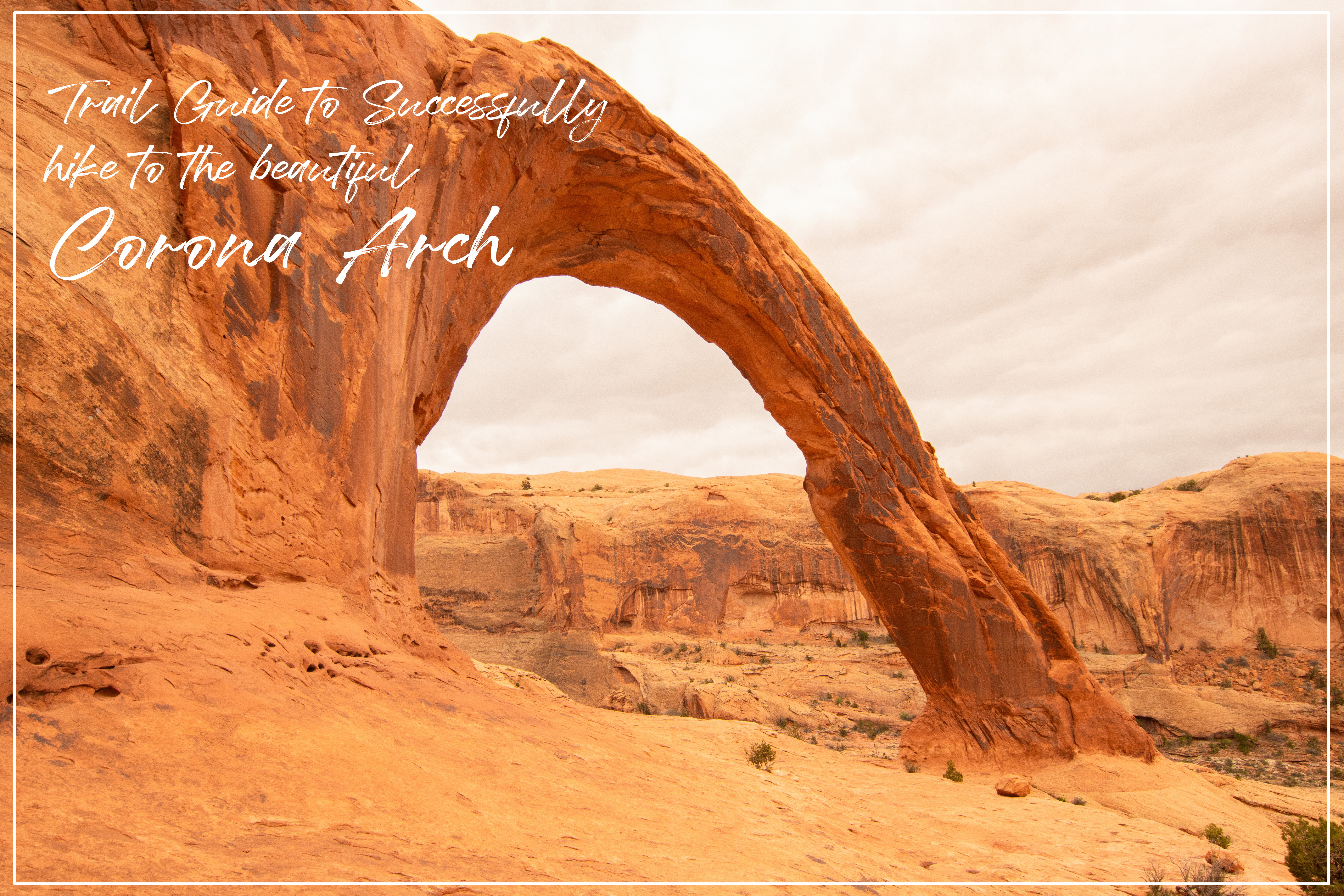
Corona Arch is an astonishing pothole arch with a height of 105 feet tall. It is a Navajo sandstone arch located near the Colorado River in Moab, Utah, and it is double the size of the famous Delicate Arch in Arches National Park. Seeing the size of this arch took my breath away, as well as the desert views throughout the entire hike. This family friendly hike is definitely one that deserves a spot on your bucketlist.
How To Get There
The trailhead parking lot is located about 10 miles down 279 along the Colorado River. It is a very short drive from Moab and Arches National Park. The parking lot is easily accessible, but during the peak season, (May-September) you may have to get there early to get a spot. The road to the parking lot is very scenic and has several campgrounds.
Best Time To Visit
The summer and fall are the most popular times to visit, but the weather is most mild in the spring. The summer sun in the Utah desert can be very strong and make for a difficult hike. There is no shade on the trail, so I would avoid doing this hike on a hot summer afternoon. I did this hike in late march, and the weather was perfect and we had no problem getting a parking spot. I recommend visiting in early spring when the weather is nice and before the crowds come to visit. Winter weather may cause some closures, so be sure to check the weather and closure updates before you plan your trip to Corona Arch if you plan to visit in winter.
What To Pack
Sturdy hiking shoes – these are a must on most trails, but it is especially important on this trail. There are some areas of slick steep rock and some rope and ladder spots. Proper shoes will help you keep your grip.
Plenty of water – always bring more water than you think you need. The sun in Moab can be really strong and drain your energy really fast, so make sure you have a full water bottle! There is no water available at the trailhead.
Park map or downloadable map – this trail is very well maintained and easy to follow, but it is always good to have a map for the rare occasion you get lost. There is not much reception on this trail, so make sure you have a paper or downloaded map.
Snacks – there is plenty of space at the end of the trail to enjoy a quick snack before heading back to the trailhead. A small granola bar would do for this short hike.
Overview
Length: 3 miles
Difficulty: moderate
Elevation gain: 462 feet
Estimated time: 1 hour – 1 hour 30 mins
Dogs? Yes! Though there are some steep areas, there were plenty of dogs that were able to enjoy the views at the end! Be sure to bring a leash.
Detailed Walkthrough
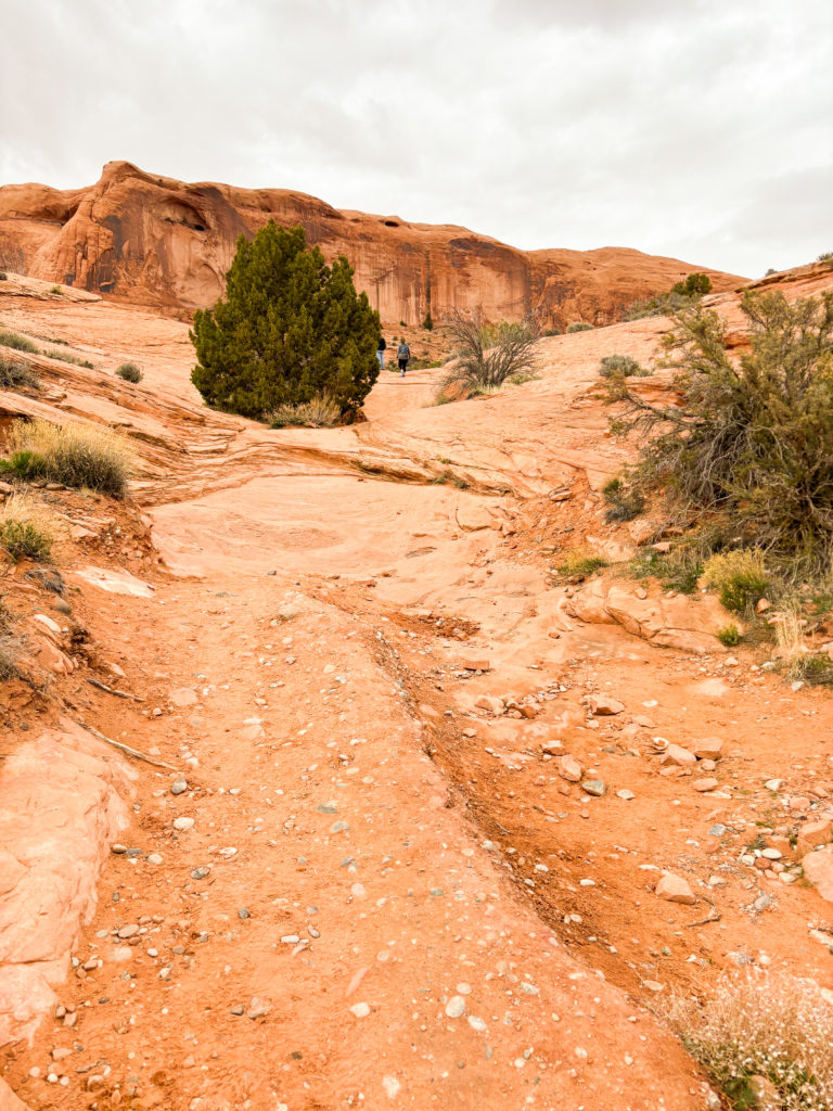
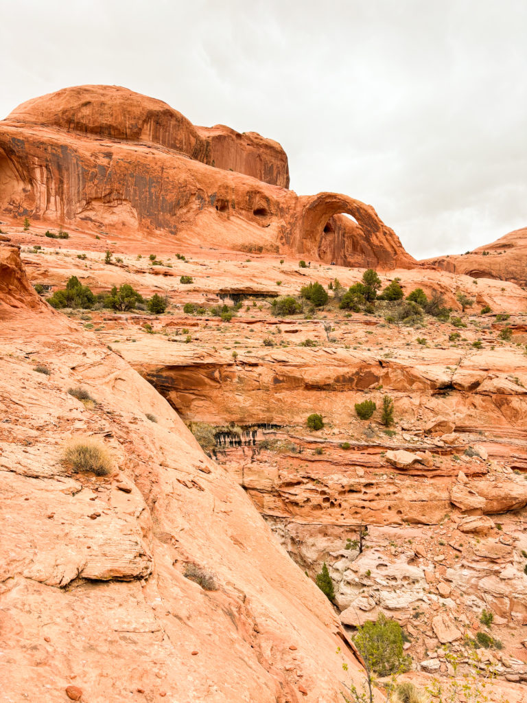
The trail begins ascending on a dirt and rock trail away from the river. You can expect some moderate elevation gain here, but nothing extreme. You will continue on this desert trail for about 3/4 of a mile. The trail will then widen into flat slick rock with a dotted path to prevent you from getting lost.
Around the 1 mile mark, the slick rock will become slightly slanted in some areas, so be sure to be careful keeping a strong grip on the rock. There is one spot with a chain and holes in the rock where you will climb a few feet up. It is nothing too scary, as it is not near any steep drop offs. Soon after that, there is a small ladder to help you get up to rock. From there, it is relatively flat to the end of the trail.
Just before the huge Corona Arch, there is another arch called Bowtie Arch up on the left side. It is pretty large and hard to miss, and it makes for a great photo along the way. Once you pass Bowtie Arch, you are at the end of the trail where you can get pictures beneath the magnificent Corona Arch. There is plenty of wide open space to explore on the rocks and take pictures before you head back the way you came.
Notes + Tips
The parking lot isn’t very big, so if you are visiting in peak season, you may want to arrive early in the morning.
This trail is a great spot for sunset, as the colors in the sky make the arch look even more beautiful!
Although there are some challenging spots, this trail is still very family friendly and reat for kids!
Love These Photos?
Click here to see more photos from Utah and the United States! All photos are available for purchase as high quality downloads.