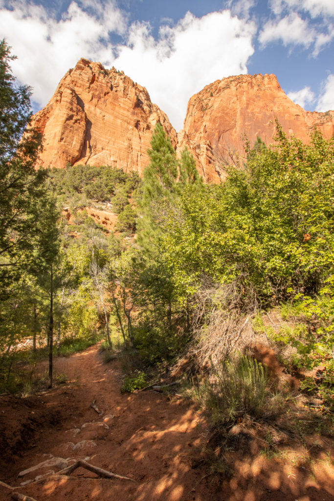
Kolob Canyon is a quiet section of Zion National Park located towards the northwest. Just because it is quieter, does not mean it’s not as beautiful as the main canyon in Zion. Its huge sandstone peaks and canyons create a serene setting for hikers that cannot be found in other southwestern parks. The unique wildlife and history of this area is absolutely worth the trip.
How To Get There
The trailhead parking lot is located about two miles up Kolob Canyon Road past the visitor center where maps and other information are available. Take exit 40 off of Interstate 15 and turn onto Kolob Canyon Road. This is the only entrance to this section of the park, you cannot drive here through the main section of Zion. You must take highway 9 west and out of the park, to 17 north, and then to I-15 north.
Best Time To Visit
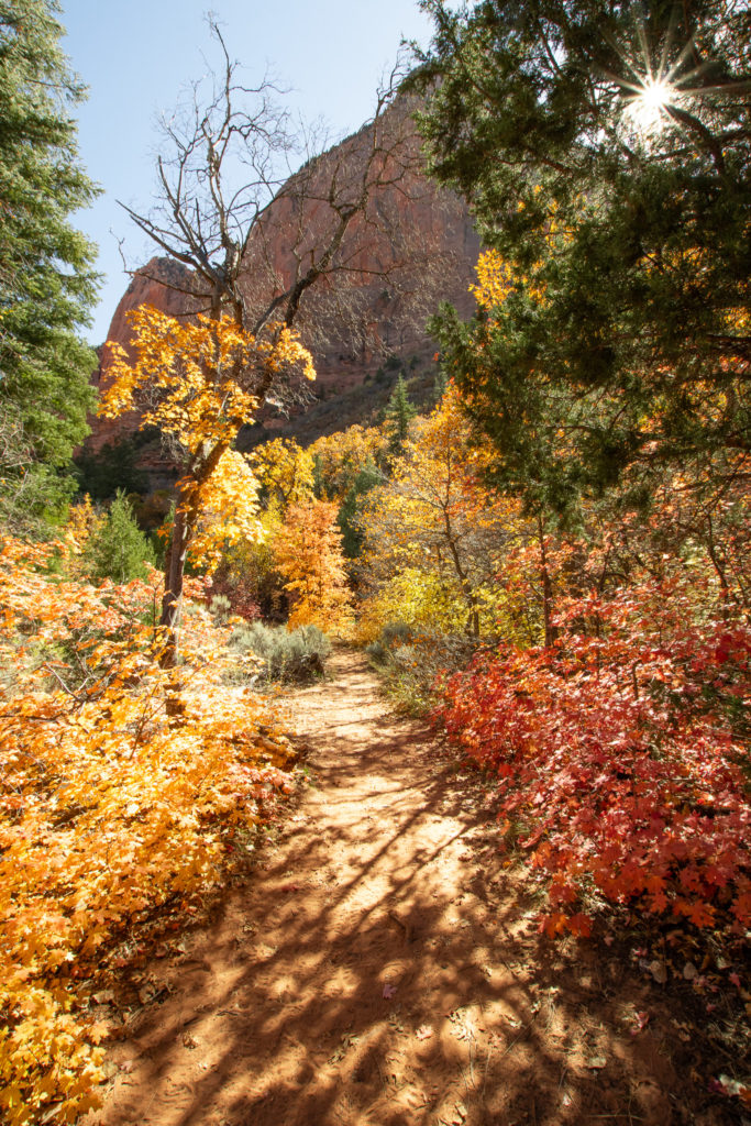
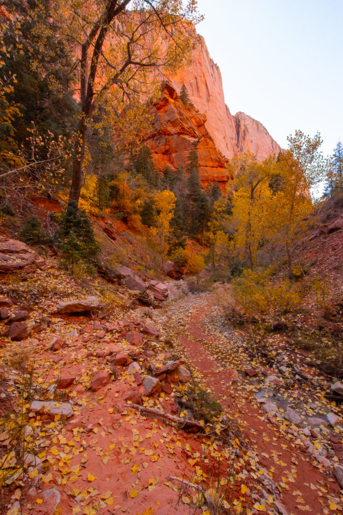
Taylor Creek trail is accessible all year, unless a winter storm causes road closures. This trail is definitely most popular in the summer when everyone is on vacation, but the weather tends to be very hot. The trail is mostly shaded, but the heat can be very draining on a long hike. I think the best time to do this hike is November because this is when the leaves of all the trees and shrubs change to beautiful shades of red, orange, and yellow. I also like to do this hike in the winter when the trail is basically empty, and I can enjoy the cave at the end all to myself. In the spring, the weather is mild, but the creek may be a little bit higher due to melted snow, and may cause you to get your feet wet.
Fees
Entrance to the park cost $35 for a private vehicle, $30 for a motorcycle, or $20 per person on foot, just like the main section of Zion. You can purchase your pass at any of the Zion visitor centers, and the pass will be valid for 7 days. America the Beautiful pass is accepted as well, and can be purchased for $80/year at the visitor centers.
What To Pack
Sturdy hiking shoes – these are a must on most trails, but this one especially. You will be hopping on rocks back and forth across the stream, and wearing proper shoes will reduce the risk of slipping.
Plenty of water – always bring more water than you think you need. Although the shade on this trail will protect you from the sun, dehydration is still a risk. There is also water available at the visitor center.
Park map or downloadable map – this trail is very well maintained and easy to follow, but it is always good to have a map for the rare occasion you get lost. There is no reception on this trail, so make sure you have a paper or downloaded map.
Snacks – this trail is on the longer side, so bring something to give you some energy while you take in the view at the end, before you make your way back.
Overview
Length: 5.3 miles
Difficulty: moderate
Elevation gain: 620 feet
Estimated time: 2 hours 30 min – 4 hours
Dogs? No, dogs are only allowed on paved areas of national parks, and this trail is mostly sand and rocks. This rule is for the protection of your pet and the protection of local plants and animals.
Detailed Walkthrough
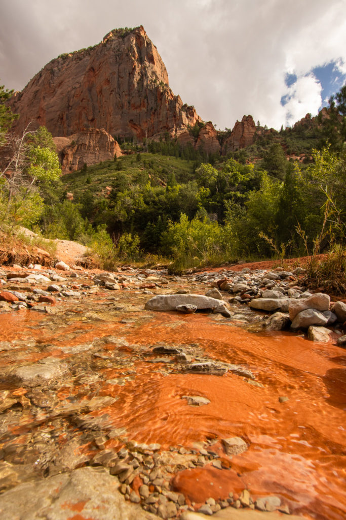
The trail begins descending down some stairs and then winds through the forest of cottonwoods and ponderosa pines. It frequently crosses the creek, but don’t worry, you won’t have to get your feet wet as long as you use the rocks as stepping stones. However, be very careful when crossing, the rocks could be loose or slippery. The first mile and a half of the trail is generally flat, and consists of dirt and some rocks.
At about miles 1 and 2, there are historical cabins built in the 1900’s. You are welcome to enjoy them and take photos from the outside, but the park prohibits hikers from entering in order to preserve them. As you arrive at the 1.5 mile mark, you may notice that the trail gets a little bit hillier and a little more challenging. There are two spots that require some minor rock scrambling, but nothing extreme. I see families and people of all ages able to complete the hike.
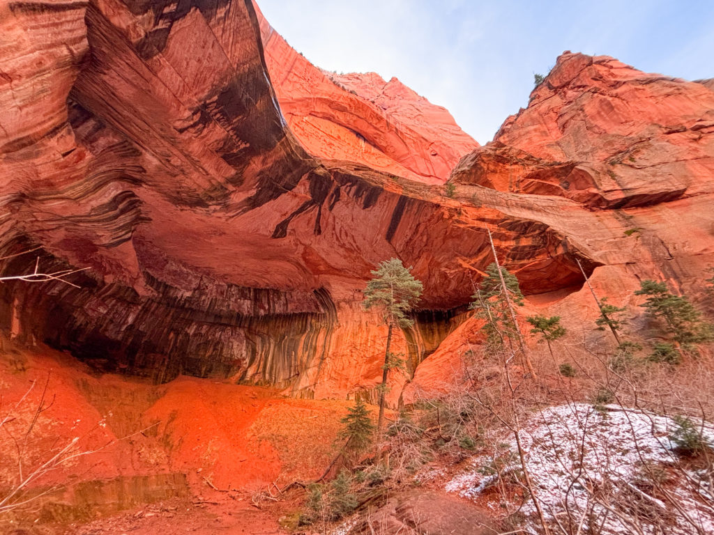
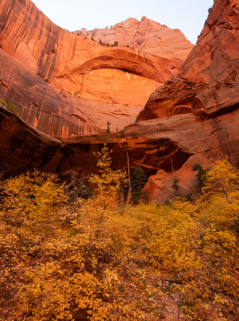
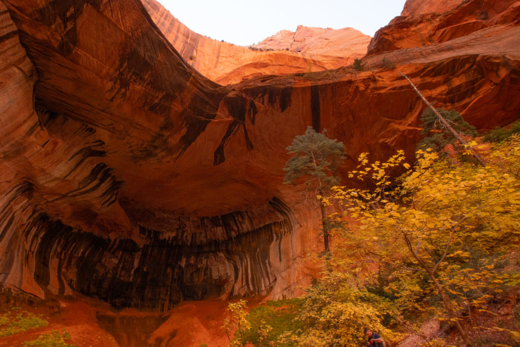
After you pass the second cabin, there is only about a quarter mile to go. This area tends to be a little colder than the rest of the trail, and it’s more shaded. At the end of the trail, you will be amazed at the Double Arch Alcove towering over you. I first did this trail with no prior knowledge and my jaw dropped when I got to the end. Voices will echo as you enter this geological wonder, and feel free to explore the inside and marvel at the red rocks surrounding you.
Notes + Tips
After rain or melted snow, this trail can be very muddy. Be sure to wear shoes you don’t mind getting dirty, hiking boots are best!
You will be crossing the trail many times. Make sure you are comfortable either walking through water or hopping on rocks to stay dry.
This trail is very family friendly, just be aware of the few steep spots that may require a step or two of climbing.
Love These Photos?
Click here to see more photos from Kolob and the United States! All photos are available for purchase as high quality downloads.