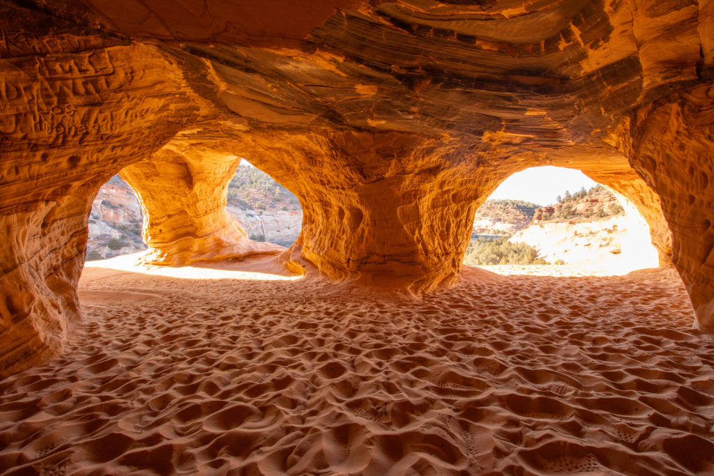
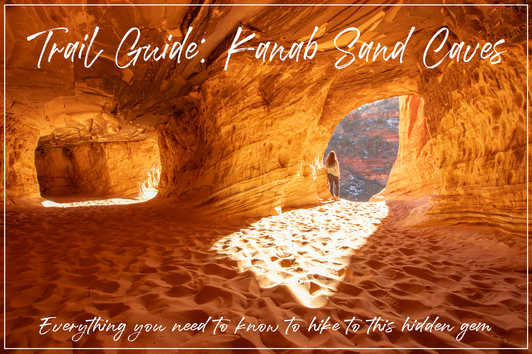
The Kanab Sand Caves are a beautiful and free hidden gem in Southern Utah. It is great for family roadtrips since it’s so close to the national parks and is just off the side of the road. The caves were man-made in the 1930’s when miners began to mine the area for the sand to make glass. However, this process didn’t last long, and now we have these beautiful caves to explore!
How To Get There
The trailhead parking lot is located about five miles north of Kanab. If you are coming from the west, you can take a more scenic route through Zion National Park, but be aware that it costs $35 per vehicle unless you have the America the Beautiful pass. You can also take highway 59 through Arizona to get to 89 as well. If you are coming from the east, 89 extends to Lake Powell and then continues south to I-40. Be careful driving out here, as there aren’t many roads or gas stations. The trailhead is just a dirt parking lot off of the road, there is no visitor center or restrooms. There are no trailhead signs, but it’s very popular so it is likely you will see other people hiking.
Best Time To Visit
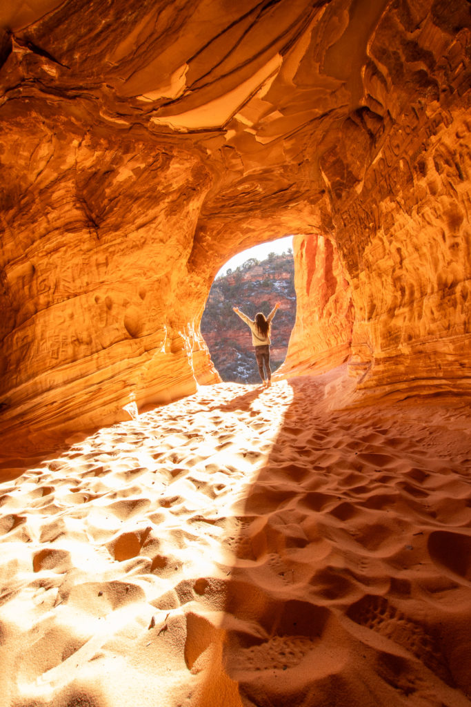
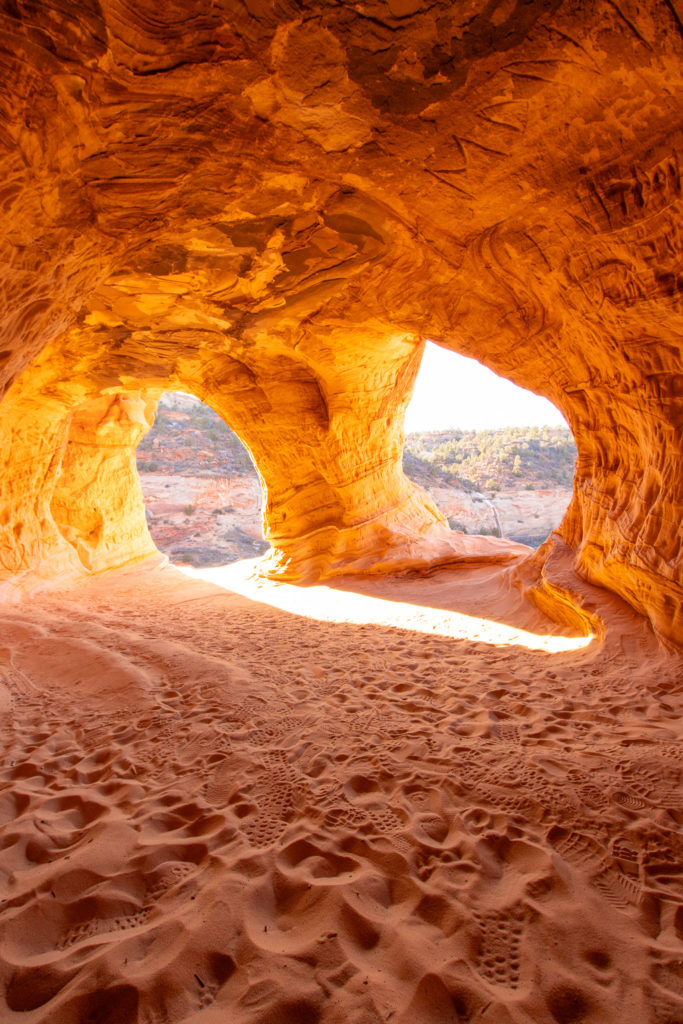
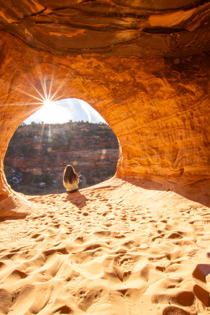
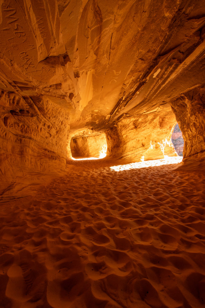
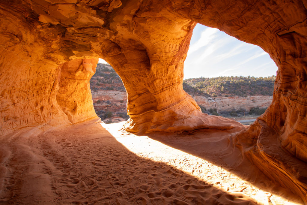
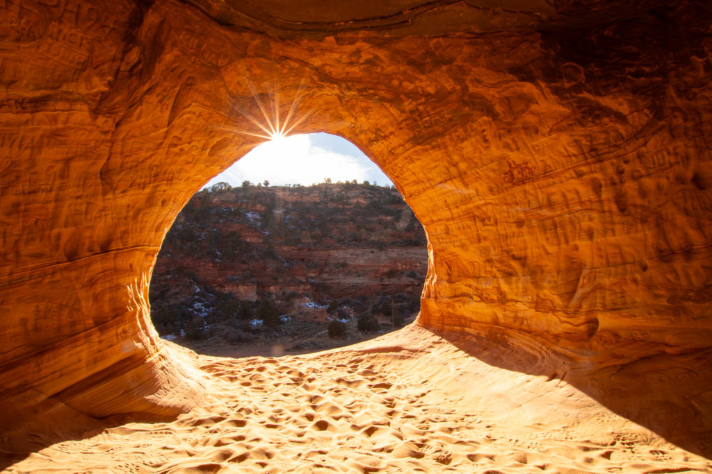
The Sand Caves trail is open year round, the most popular times to visit being summer and early fall. The weather is more mild in the fall, and the trail is the least crowded in the winter. However, snow will make the caves very difficult to reach and the trail hard to follow. As for time of day, the absolute best time is 1 – 2 hours before sunset. The caves face the west, so when the sun sets, it shines in the caves and creates amazing shadows and golden light. If you go earlier in the day, the caves will be pretty dark and won’t make for as good of photos.
What To Pack
Sturdy hiking shoes – these are a must on most trails, but this one especially. There is one area where you need to hike on steep, smooth rock. Proper shoes will help you keep your grip. Even though the end is sandy, don’t wear flip flops for this hike.
Plenty of water – this trail is short, but I feel it is always important to bring enough water, especially when the sun is hot. There isn’t much shade until the caves.
Downloadable map – this trail is not very well marked or maintained. I highly recommend downloading a map such as on AllTrails, so you can find your way. There isn’t much reception, so make sure it’s downloaded and not just online.
Overview
Length: 1.2 miles
Difficulty: moderate
Elevation gain: 121 feet
Estimated time: 1 hour 30 mins – 2 hours
Fees? None! this trail is not part of any parks so it is completely free!
Dogs? Yes, but not recommended. Dogs are allowed on the trail if they are on a leash. However, please note that there are some very steep spots that may be very difficult for a dog to make it.
Detailed Walkthrough
The trail begins as a narrow dirt trail that weaves through shrubs and juniper trees. Try to keep a downloadable map on hand to help you stay on the main trail since there are some side trails that look misleading. The trail will continue this way for about a half a mile. The trail is pretty much flat until you reach the half mile mark. You will pass the caves above you then the trail makes a U-turn that goes up a steep slope towards the caves.
This part of the trail is the most difficult and definitely requires hiking shoes with good grip. The slope is very steep with a little bit of sand on it, making it difficult to keep a grip. Take your time on this part and search for the flattest way across the slope. If you are having trouble following the trail, follow other hikers who may be able to help you find the way.
Once you pass the slope, you are in the clear. You only have to walk along the ridge for about a tenth of a mile and you will arrive at the caves. Feel free to explore as long as you want and capture some awesome pictures. Then you will return back the way you came from. Again, take your time on the slope, especially going down.
Notes + Tips
After rain or melted snow, this trail can be very muddy. Be sure to wear shoes you don’t mind getting dirty, hiking boots are best!
If you are roadtripping, Zion National Park is very close by! You can include both of these spots on your itinerary!
Love These Photos?
Click here to see more photos from the Sand Caves and the United States! All photos are available for purchase as high quality downloads.