
About Sedona ———————–
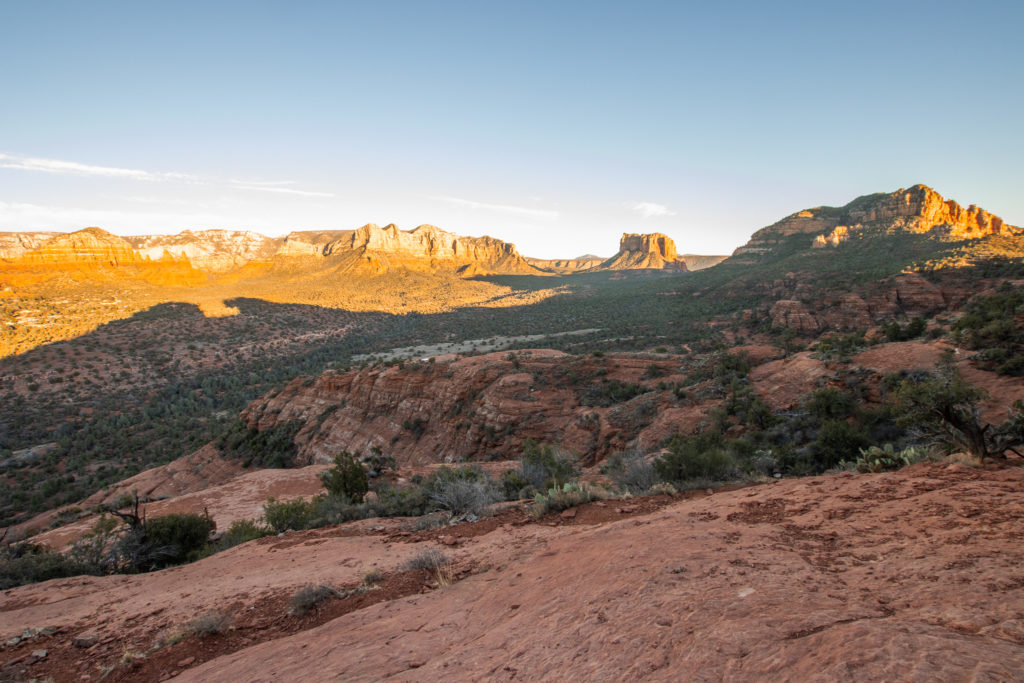
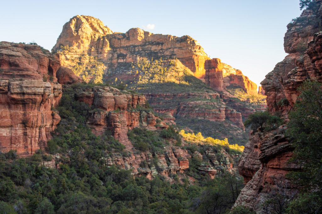
Sedona is a place with miles of natural beauty and even more miles of stunning hiking trails. I spent an entire weekend here and I barely scratched the surface of this amazing place. There is so much to explore outside, as well as in town. Aside from its amazing views, Sedona has long been believed to be a spiritual hotspot making it a sacred place to many people. You can learn all about this spiritual vortex and see if you can feel the Sedona energy for yourself!
How To Get There
Sedona is located roughly in the middle of Arizona, about an hour south of Flagstaff. If you are coming west from the Las Vegas area, follow Interstate 40 and head south on highway 89 once you reach Flagstaff. From the north, you can follow highway 89 all the way south to Sedona and pitstop in Page to see an incredible view of the Colorado River at Horseshoe Bend. If you’re coming from Phoenix, it is an easy 2 hour drive. Just take I-17 north up to 179 west to Sedona.
Best Time To Visit
There is really no bad time to visit Sedona, but the fall and spring are considered to be the most ideal times due to the mild weather in the range of 70’s and 80’s. Flowers bloom between March and May, and the leaves change into beautiful shades of orange and red in late September and October. Summers in Arizona can get extremely hot, and many people are on summer vacation so it can be quite crowded. If you are looking to avoid the crowds, then December and January are the best months for you. It will be chilly, but the red rocks look incredible in the snow and make for great photos.
What To Pack
Sturdy hiking shoes – these are a must on many trails in Sedona, since some of the hikes can be very steep or long. You will want to make sure you wear shoes that are comfortable and will help prevent you from slipping on slick rock.
Plenty of water – always bring more water than you think you need. The Arizona sun is stronger than you think. Even in February, the sun felt very hot and drained some energy.
Park map or downloadable map – The trails in Sedona are very well maintained and frequently traveled, so it is unlikely you will get lost. However, it is smart to have a paper or downloaded map so you can always find your way back in case you get lost without cell reception.
Snacks – snacks with lots of protein and carbs will help keep you energized to maximize your hiking adventure. I like to bring granola bars, sandwiches, or anything that is easy to carry and won’t go bad.
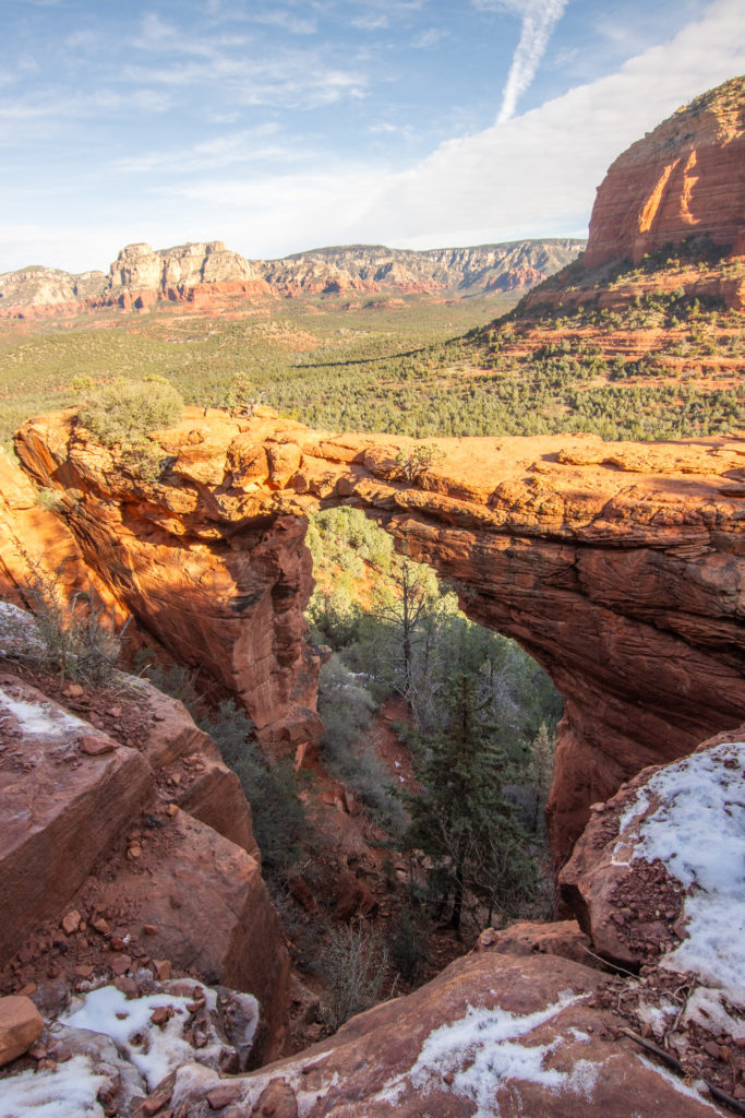
1. Devil’s Bridge via Mescal Trailhead
Overview
Length: 3.9 miles
Difficulty: moderate
Elevation gain: 528 feet
Estimated time: 2 hours – 2.5 hours
Dogs? Yes! As long as your pup is on a leash, they are welcome to enjoy this adventure with you!
Detailed Walkthrough
There are several ways to get to the Devil’s Bridge, so this is just one of the options. the Mescal trailhead area has a good amount of parking, however, it is still a good idea to get an early start so you can ensure that you get a spot. The parking lot and trailhead are located off of Long Canyon Road a short drive north of town.
The first mile and a half of the trail is dirt and mostly flat. For the last half mile, you can expect a decent amount of rock stairs and a few steep steps towards the end. At the summit, there is lots of space to relax and enjoy the view. This is one of the most popular trails in Sedona, so expect to share the view with several other hikers.
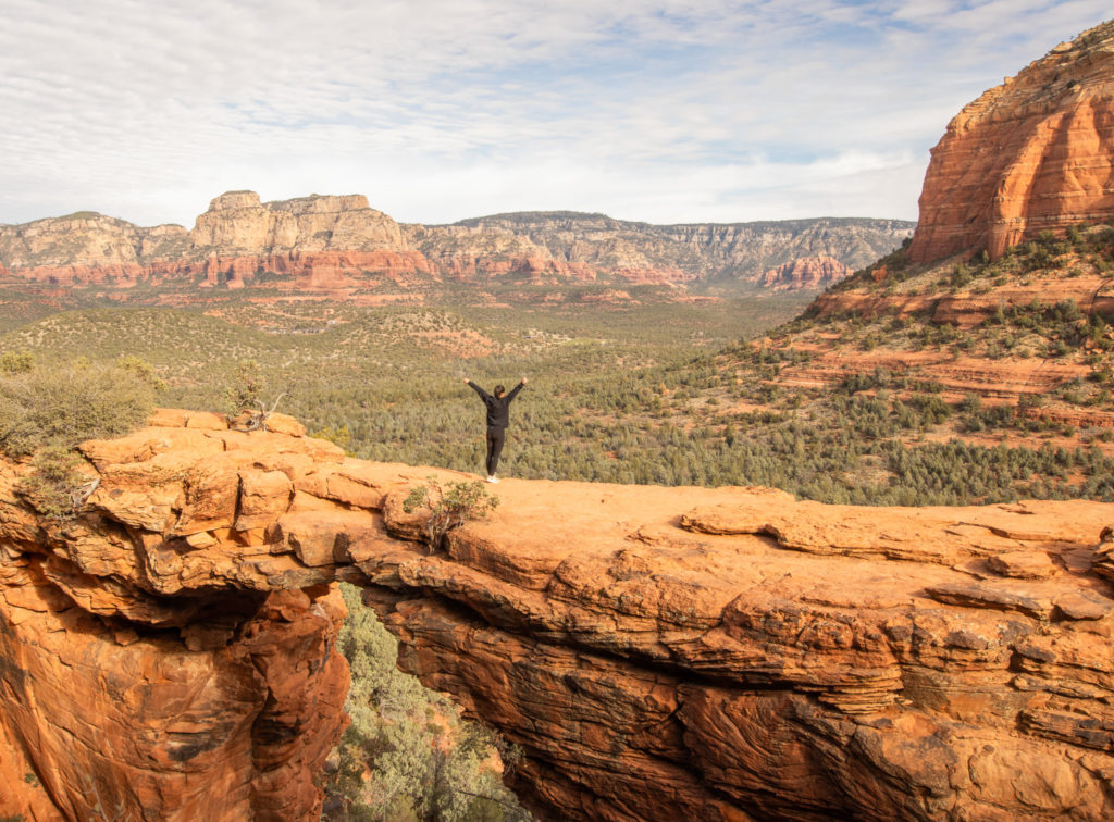
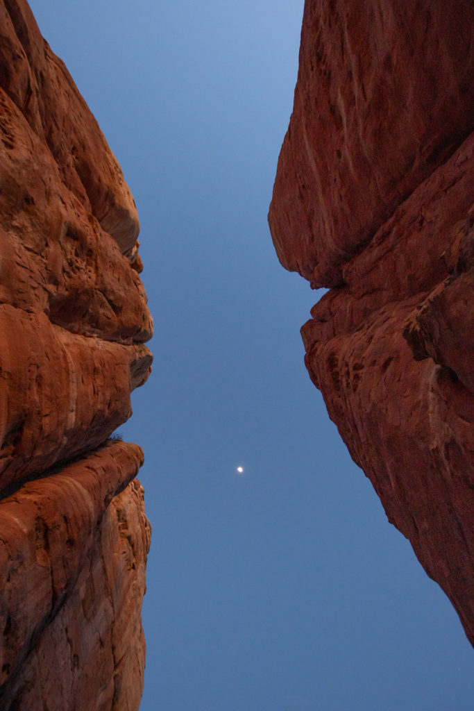
The bridge is open for people to walk on as long as you’re not too afraid of heights. The bridge is wider than it looks in pictures, and I think it is definitely worth taking a photo on it as long as you are careful. There will most likely be a small line of people waiting at the side so everyone can get their photos without other people on the bridge. Once you’re satisfied with the view and your photos, follow the same trail back down for about 2 miles back to the trailhead.
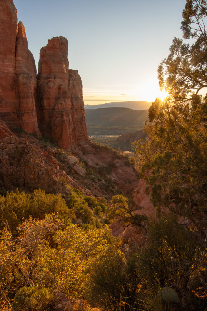
1. Cathedral Rock
Overview
Length: 1.2 miles
Difficulty: hard
Elevation gain: 741 feet
Estimated time: 1 hour – 1.5 hours
Dogs? Yes! As long as your pup is on a leash, they are welcome to enjoy this adventure with you! Be aware that most of the trail is very steep and can be crowded. Use your best judgement to decide if your pup can handle this hike.
Detailed Walkthrough
Cathedral Rock is another very popular trail, but it’s definitely one you can’t miss. There will be a crowd, but the view is so worth it. I highly recommend starting this hike about and hour or 45 minutes before sunset so you can watch the sun set beyond the distant mountains. The golden sunlight makes the view so much more incredible as you hike.
Expect to hike up a lot of rock stairs in the beginning of the trail. The trail will ascend for the entire way up, so bring water and take breaks as needed. About half way up the hike, the stairs will become wide slick rock. Proper hiking shoes are essential for this hike since it is very easy to slip on the sandy steep rock. In some spots there are wide cracks in the rock that are helpful for making your way up the trail.
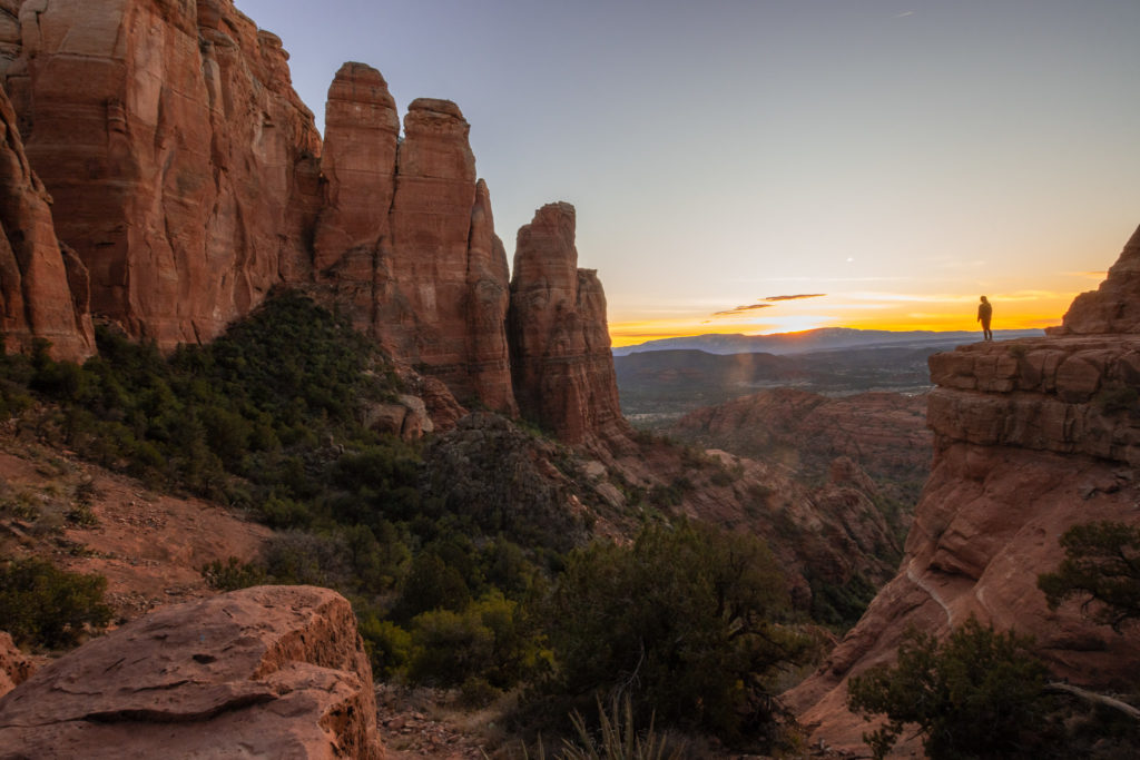
Once you reach the top and catch your breath, your breath will be taken away once again when you see the view from the top of this hike. You are surrounded by tall red rock spires and you can see for miles to the distant mountains. You can explore this area a little bit and get an awesome photo from this really cool ledge located to the right side of the rocks.
Take your time going down, especially on the steep parts. If you are hiking in the dark after the sunset, use a headlamp so you can see the steps on the way down.
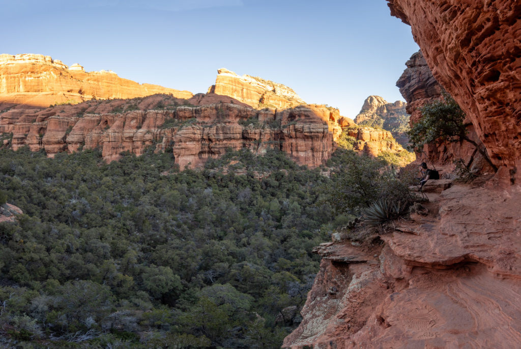
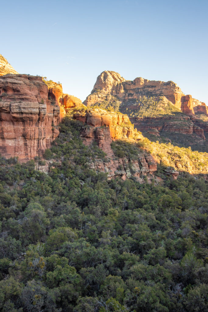
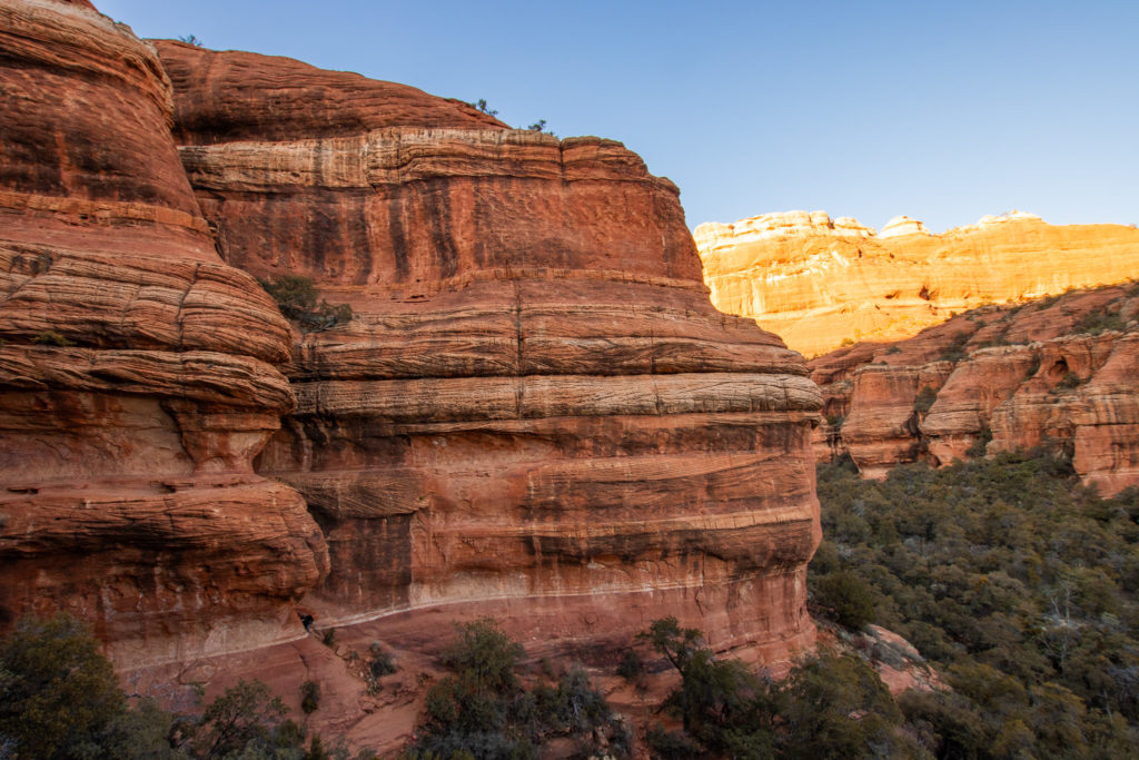
1. Boynton Canyon to the Birthing Cave
Overview
Length: 4.4 miles
Difficulty: moderate
Elevation gain: 485 feet
Estimated time: 2 hours- 2.5 hours
Dogs? Yes! As long as your pup is on a leash, they are welcome to enjoy this adventure with you! Be aware that the trail into the subway cave at the end is very steep and may be difficult for dogs. However, the whole trail up to the very end is very dog friendly.
Detailed Walkthrough
This trail winds through a canyon with red rock and forested views. The entire trail is dirt and rocks, and has very mild inclines. You will hike behind a small neighborhood in the beginning, and the trail will become more secluded as you go on. If you hike early in the morning or in the late afternoon, you will have some shade from the small trees and mountains in the area.
At about 1.5 miles in, you will make a right at a divide in the trail. This will take you to the subway cave formation called the Birthing Cave. If you continue straight, the trail will continue through the canyon for about another mile or so. It’s beautiful, but there is no grand view at the end. If you can only do one, I recommend going right to see the cave. The trail only becomes slightly difficult if you decide to climb into the cave. You can take in the views from below, or take a small adventure up into the subway for an even better view.
These are only a few of the many incredible hiking trails in Sedona. They are some of the more popular ones, but definitely worth seeing if it’s your first and possibly only time in Sedona. These are great ones to try to fit in a weekend if that’s all the time you have like I did. There is so much more to explore here, and I can’t wait to go back to see the rest of this beautiful place!
Love These Photos?
Click here to see more photos from Sedona and the United States! All photos are available for purchase as high quality downloads.